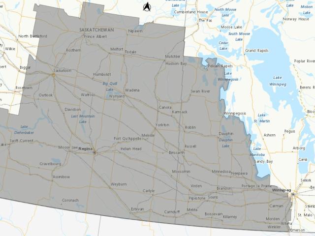
There's a Special Weather Statement over the entire South Western Corner of the Province.
A Colorado Low in the Northern Plains of the United States is expected to bring a prolonged period of Rain to the Southern Prairies. Total snowfall's expected to be in the 10 to 20 cm range, starting tomorrow night, into Wednesday, and Possibly Thursday.
The following areas are currently under the statement.
- Dauphin - Russell - Roblin - Winnipegosis
- Ste. Rose - McCreary - Alonsa - Gladstone
- Minnedosa - Riding Mountain National Park
- Swan River - Duck Mountain - Porcupine Provincial Forest
- Brandon - Neepawa - Carberry - Treherne
- Killarney - Pilot Mound - Manitou
- Melita - Boissevain - Turtle Mountain Provincial Park
- Virden - Souris
- Morden - Winkler - Altona - Morris
- Portage la Prairie - Headingley - Brunkild - Carman
Several uncertainties and complicating factors remain to be determined with this system. Mild temperatures ahead of this system and heavy, wet snow will lead to plenty of melting and compaction on contact as it accumulates.
Precipitation will likely be mixed at times with rain, especially over south-central Manitoba. Current thinking is that precipitation will begin overnight Tuesday into Wednesday for most regions, although there may be an area of mixed precipitation ahead of the main area on Tuesday afternoon into the evening.

