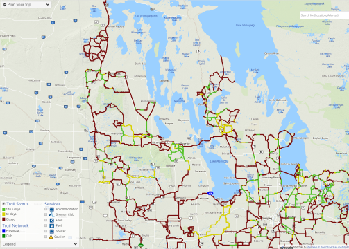
Snoman has a new interactive map that snowmobilers across the Parkland can use to see which trails are closed and which are freshly groomed.
Al Butler, President of Snoman, explains what’s changed this year.
“The old maps we had that were on the website were basically just a picture of our trail system. The new interactive map allows you to go in and expand it, you can plan routes by taking your mouse and clicking on one point and go to another point, and it will give you the distance between those two points.”
Each groomer is equipped with GPS units. So within 24 hours of a trail being groomed, it will turn green, and after five days it will become yellow.
The system is like programs used in neighbouring provinces. The group likes to see consistency between the provinces of Ontario and Saskatchewan. With the new maps, all three have basically the same system.
The map can be found here.
Snoman is also developing a mobile app that should be ready to download in the next few weeks.

